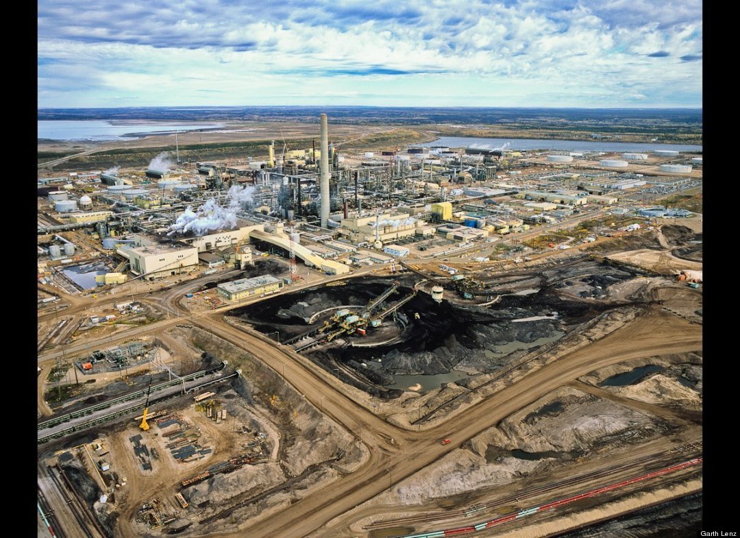
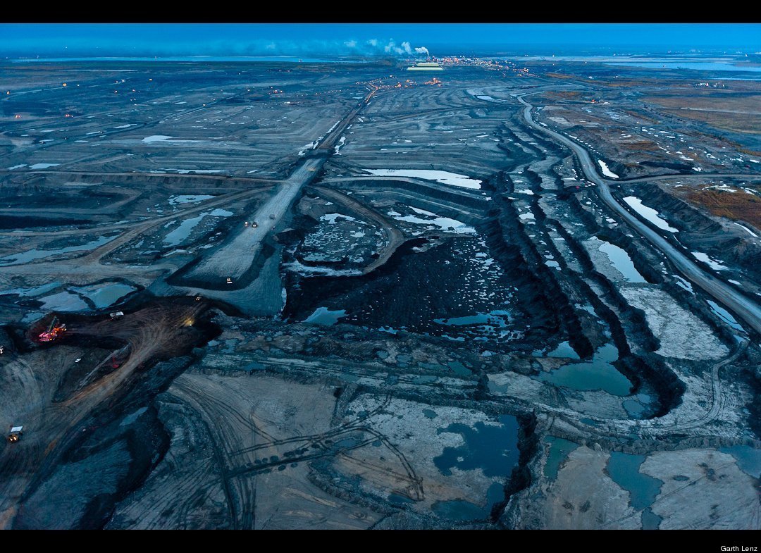
Syncrude Upgrader and Oil Sands
The refining or upgrading of the tarry bitumen which lies under the oil sands consumes far more oil and energy than conventional oil and produces almost twice as much carbon. Each barrel of oil requires 3-5 barrels of fresh water from the neighboring Athabasca River. About 90% of this is returned as toxic tailings into the vast unlined tailings ponds that dot the landscape. Syncrude alone dumps 500,000 tons of toxic tailings into just one of their tailings ponds everyday.
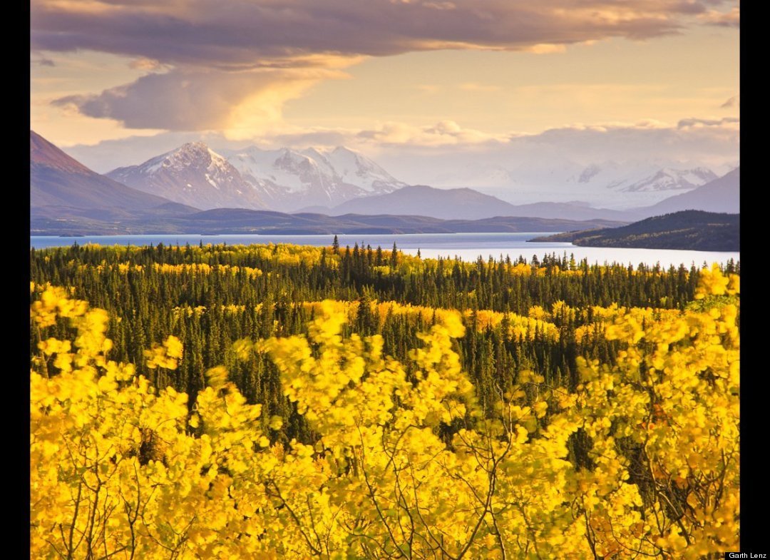
Boreal Forest and Coast Mountains / Atlin Lake, British Columbia | 2001
This area, located in the extreme northwest of British Columbia, marks the western boundary of the Boreal region. On the border of the Yukon and Southeast Alaska, the western flank of these mountains descends into Alaska's Tongass Rainforest and British Columbia's Great Bear Rainforest. Far from the oil sands, the greatest remaining coastal temperate and marine ecosystem is imminently threatened by the proposal to build a 750-mile pipeline to pump 550,000 barrels per day of oil sands crude to the coast. Once there, it would be shipped through some of the most treacherous waters, virtually assuring an ecological disaster at some point in the future.
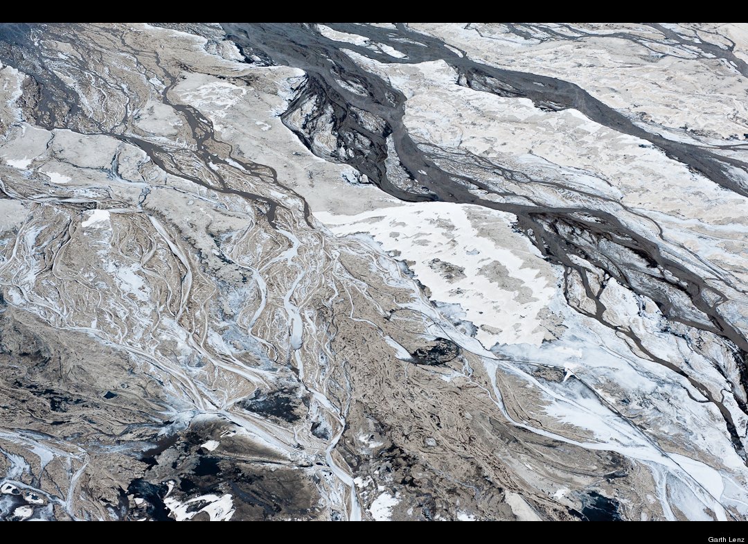
Tailings Pond in Winter, Abstract #2 / Alberta Tar Sands | 2010
Even in the extreme cold of the winter, the toxic tailings ponds do not freeze. On one particularly cold morning, the partially frozen tailings, sand, liquid tailings and oil residue, combined to produce abstractions that reminded me of a Jackson Pollock canvas.
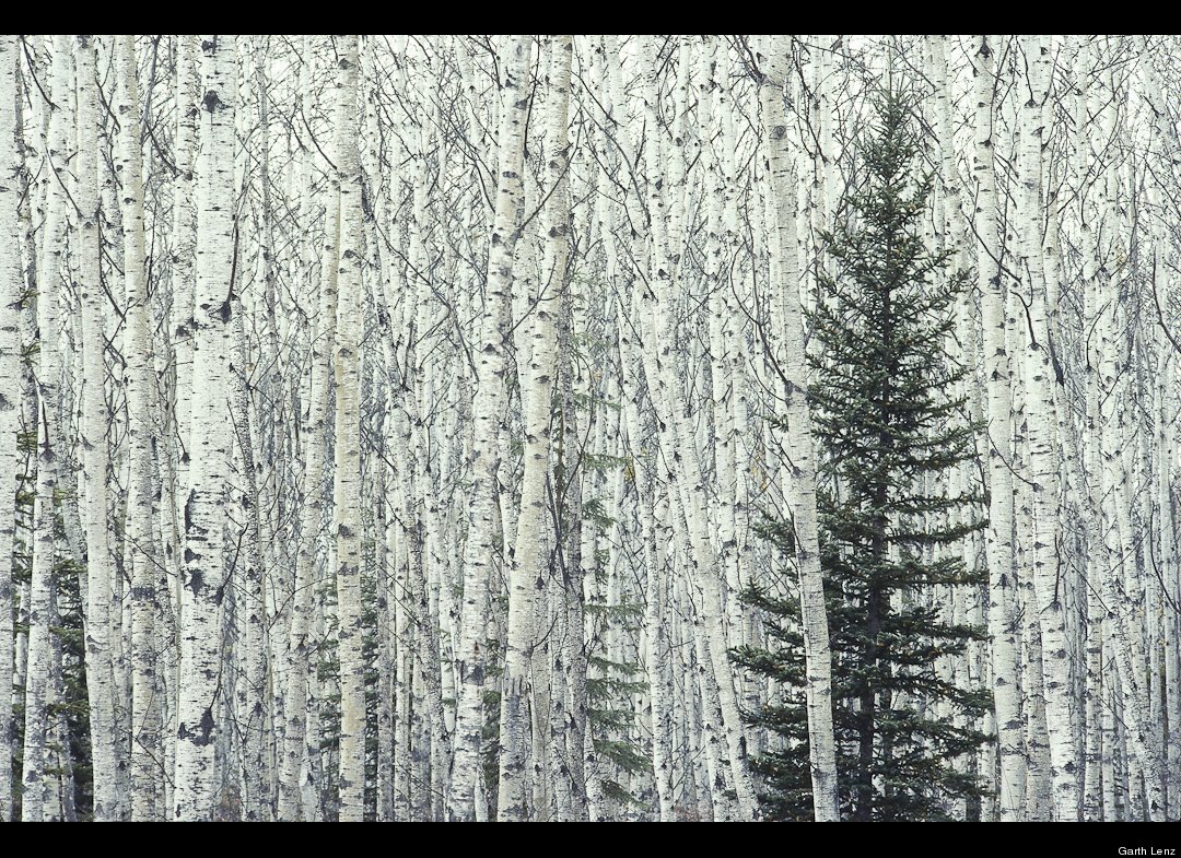
Aspen and Spruce | Northern Alberta | 2001
Photographed in late autumn in softly falling snow, a solitary spruce is set against a sea of aspen. The Boreal Forest of northern Canada is perhaps the best and largest example of a largely intact forest ecosystem. Canada's Boreal Forest alone stores an amount of carbon equal to ten times the total annual global emissions from all fossil fuel consumption.
Tar Sands at Night #1 | Alberta Oil Sands | 2010
Twenty four hours a day the oil sands eats into the most carbon rich forest ecosystem on the planet. Storing almost twice as much carbon per hectare as tropical rainforests, the boreal forest is the planet's greatest terrestrial carbon storehouse. To the industry, these diverse and ecologically significant forests and wetlands are referred to as overburden, the forest to be stripped and the wetlands dredged and replaced by mines and tailings ponds so vast they can be seen from outer space.
Dry Tailings #2 | Alberta Tar Sands | 2010
In an effort to deal with the problem of tailings ponds, Suncor is experimenting with dry tailings technology. This has the potential to limit, or eliminate, the need for vast tailings ponds in the future and lessen this aspect of the oil sands' impact.
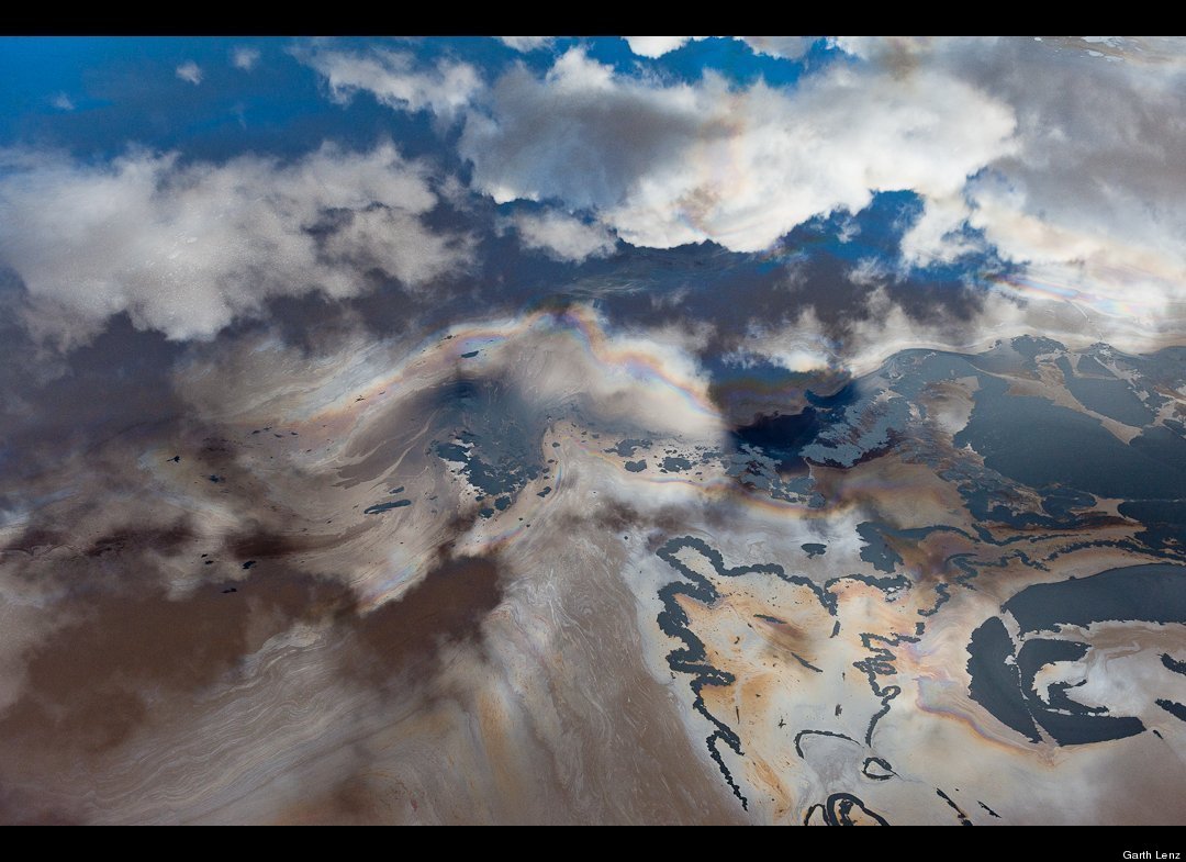
Tailings Pond Abstract #2 | Alberta Tar Sands / 2010
So large are the Alberta Tar Sands tailings ponds that they can be seen from space. It has been estimated by Natural Resources Canada that the industry to date has produced enough toxic waste to fill a canal 32 feet deep by 65 feet wide from Fort McMurray to Edmonton, and on to Ottawa, a distance of over 2,000 miles.
In this image, the sky is reflected in the toxic and oily waste of a tailings pond.
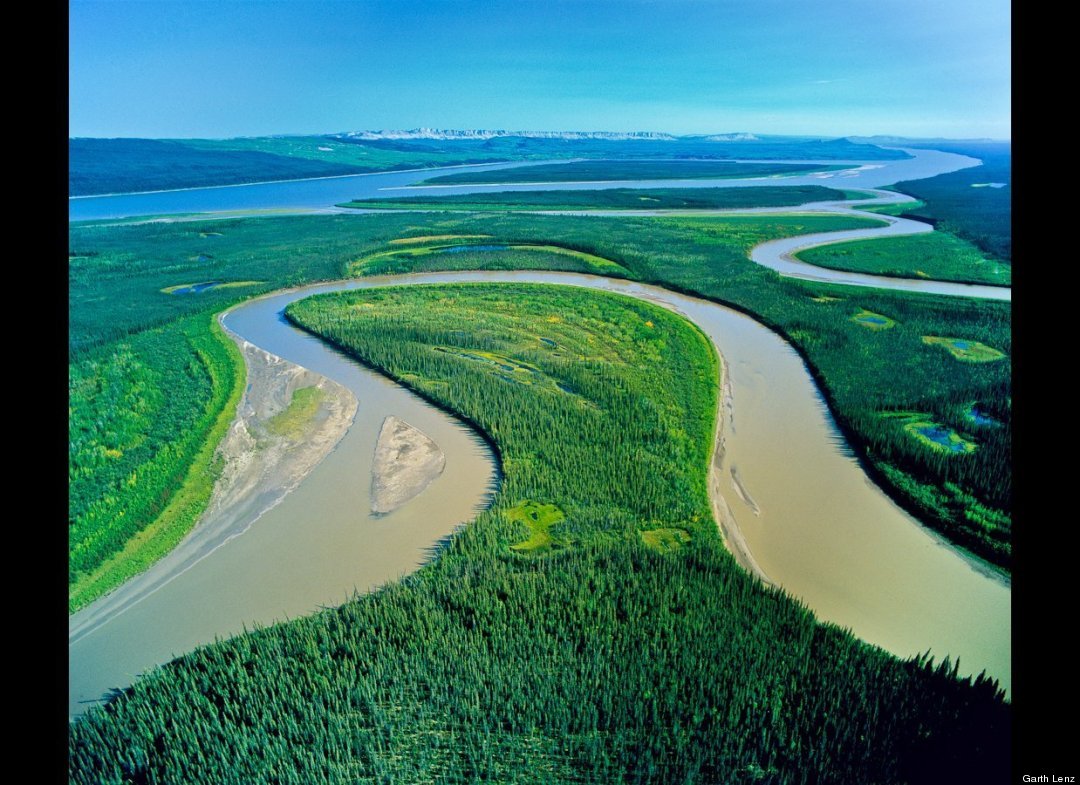
Confluence of Carcajou River and Mackenzie River | Mackenzie Valley, NWT | 2005
The Caracajou River winds back and forth creating this oxbow of wetlands as it joins the Mackenzie flowing north to the Beaufort Sea. This region, almost entirely pristine, and the third largest watershed basin in the world, will be directly impacted by the proposed Mackenzie Valley National Gas Pipeline to fuel the energy needs of the Alberta Oil Sands mega-project.
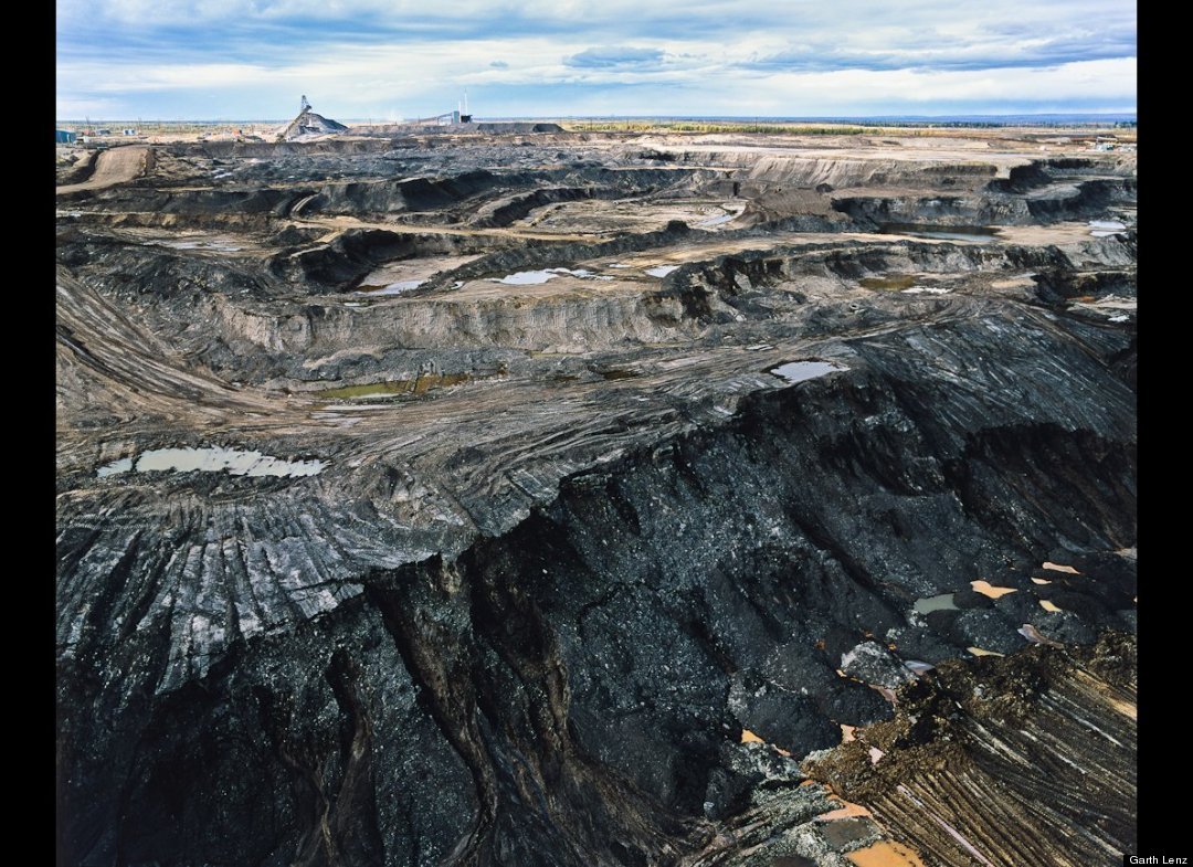
Black Cliff | Alberta Oil Sands | 2005
Oil sands pit mining is done in benches or steps. These benches are each approximately 12-15 meters high. Giant shovels dig the oil sand and place it into heavy hauler trucks that range in size from 240 tons to the largest trucks, which have a 400-ton capacity.
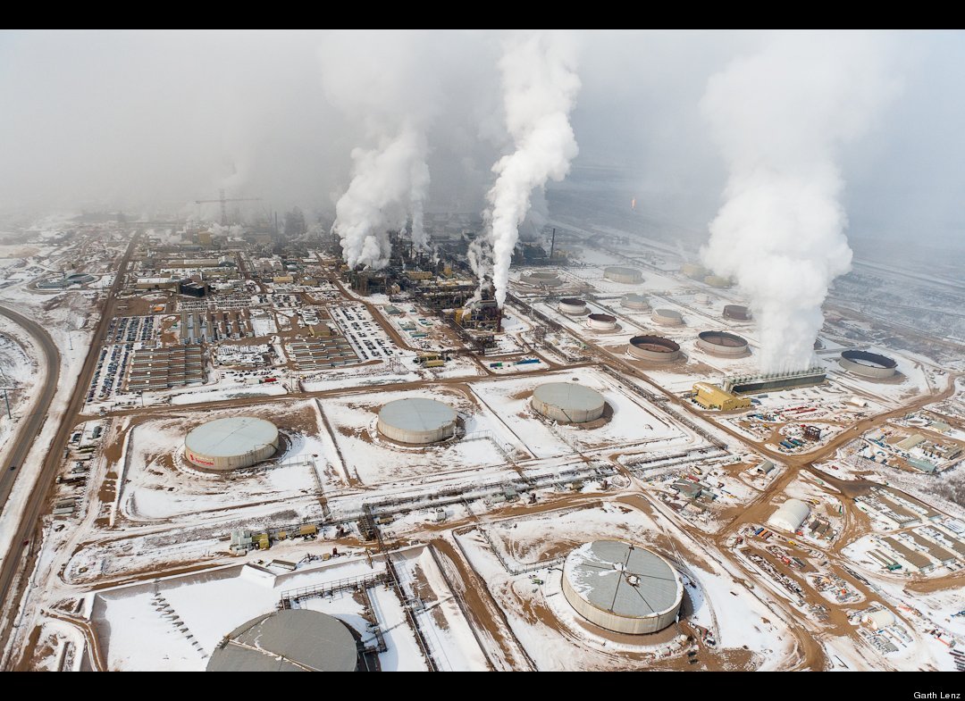
Oil Sands Upgrader in Winter| Alberta Oil Sands | 2010
The Alberta oil sands are Canada's single largest source of carbon. They produce about as much annually as the nation of Denmark. The refining of the tar-like bitumen requires more water and uses almost twice as much energy as the production of conventional oil. Particularly visible in winter, vast plumes of toxic pollution fill the skies. The oil sands are so large they create their own weather systems.
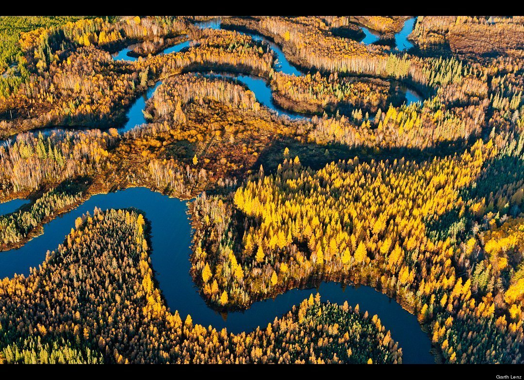
Boreal Forest and Wetland | Athabasca Delta Northern Alberta | 2010
Located just 70 miles downstream from the Alberta oil sands, the Athabasca Delta is the world's largest freshwater delta. It lies at the convergence of North America's four major flyways and is a critical stopover for migrating waterfowl and considered one of the most globally significant wetlands. It is threatened both by the massive water consumption of the tar sands and its toxic tailings ponds.
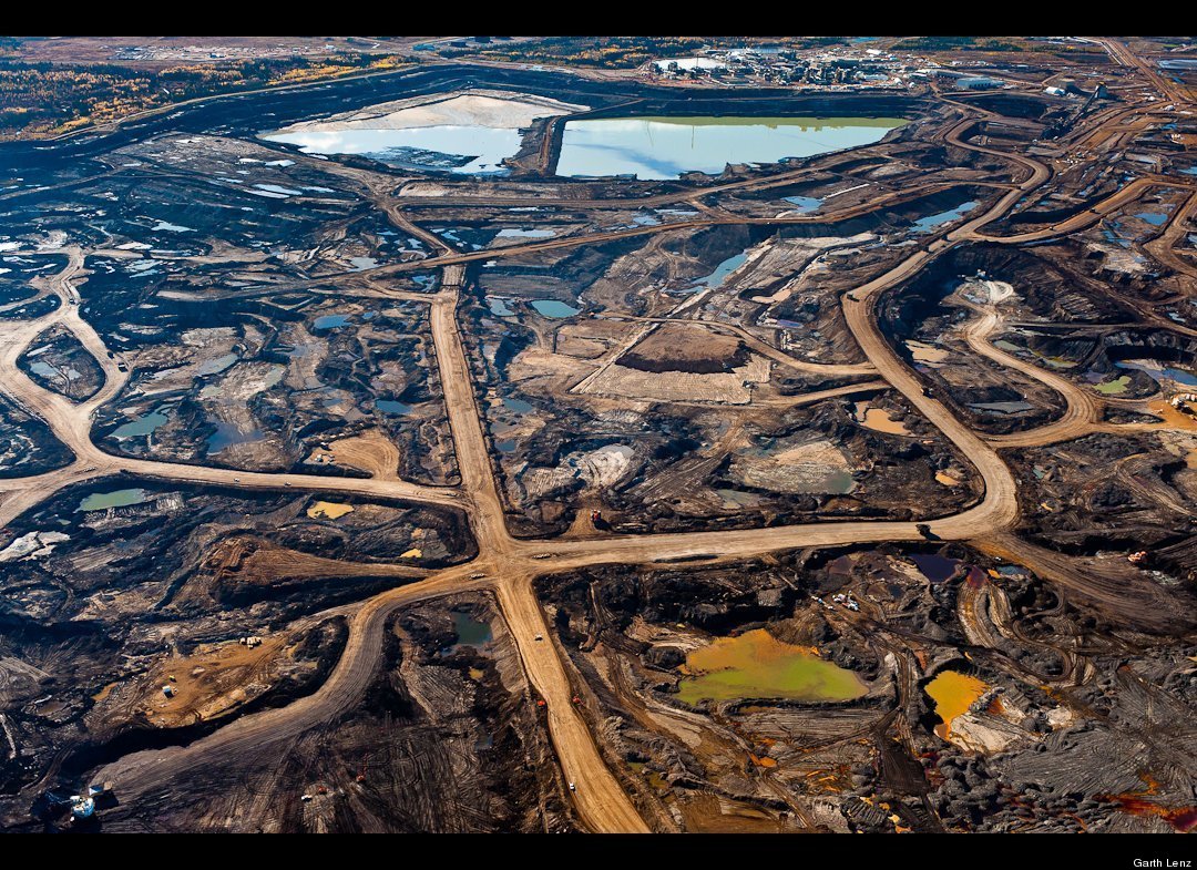
Tar Pit #3
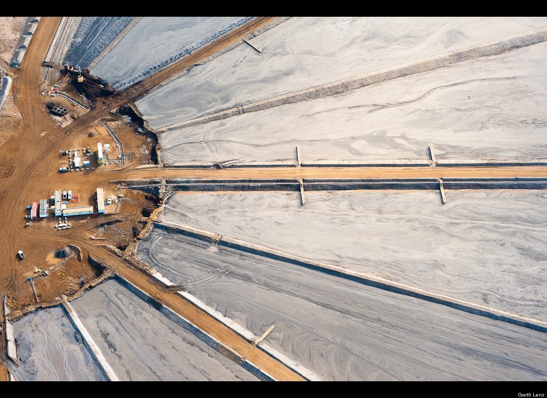
This network of roads reminded me of a claw or tentacles. It represents for me the way in which the tentacles of the tar sands reach out and wreak havoc and destruction. Proposed pipelines to American Midwest, Mackenzie Valley, and through the Great Bear Rainforest will bring new threats to these regions while the pipelines fuel new markets and ensure the proposed five fold expansion of the oil sands.
No comments:
Post a Comment